From the app
A real chart, not a mockup
This is FlyHedral Charts mid-drill — a live FAA VFR sectional with one airport symbol in the crosshairs and the question beside it.
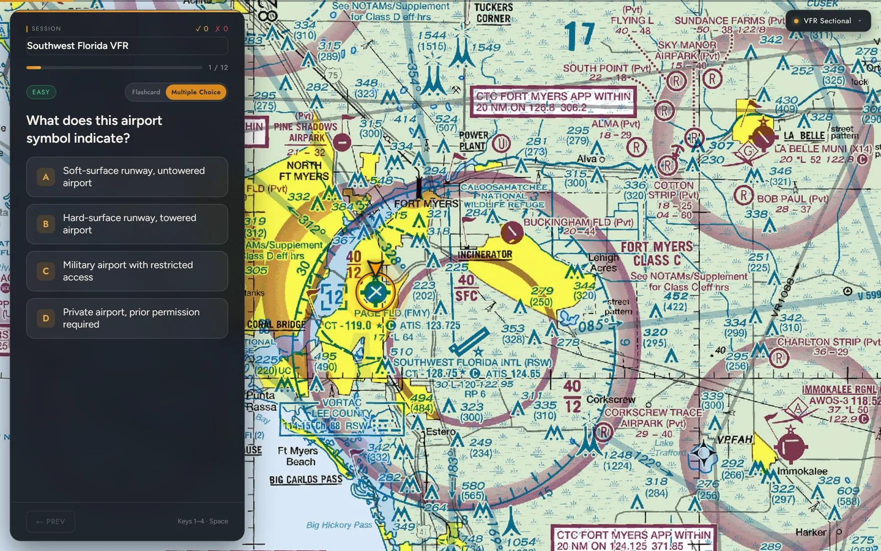
FlyHedral Charts doesn't hand you a legend page and hope it sticks. It flies the map to a real FAA sectional or IFR symbol, quizzes you cold, and shows you exactly where that symbol lives on the chart you'll actually fly with.
This is FlyHedral Charts mid-drill — a live FAA VFR sectional with one airport symbol in the crosshairs and the question beside it.
Charts skips the flat legend page entirely. Every card is a real chart feature at its real coordinates — you fly to it, answer cold, and read the reasoning before the next one loads.
The camera banks onto the actual VFR Sectional or IFR Low Enroute tile at the feature's real coordinates — not a cropped screenshot or a redrawn symbol.
Multiple choice grades you instantly; flashcard mode has you commit, reveal, and self-score. A pulsing arrow marks a point feature, a soft vignette rings an area feature.
Every card closes with the reasoning behind the symbol — the color, the line type, the shape — so it sticks past this one question.
"Pilots don't miss chart questions because they never saw a legend — they miss them because they never saw the symbol on a real chart before test day. So the app doesn't show a legend. It flies you to the chart."
Six things Charts actually does today — no chart-viewing mode, no filler.
VFR Sectional and IFR Low Enroute, pulled straight from FAA's own tile servers — the actual chart, not a screenshot or a redraw.
Every question opens with the camera animating to that feature's real coordinates, so you learn where things sit on the chart — not just what they look like on a legend page.
Answer A/B/C/D for instant grading, or run flashcard mode — commit to an answer, reveal it, then score yourself Got it or Missed it.
Every card closes with an explanation — why the color, the shape, or the line type means what it does, and why it matters in the cockpit.
A pulsing arrow marks a point feature like an airport or navaid; a soft dashed vignette rings an area feature like a Class C shelf or an MOA boundary.
Space to reveal or advance, 1–4 to answer, arrow keys to move card to card, F and L to swap mode and chart layer.
Southwest Florida VFR is the first drillable region — real airports, airspace, and navaids around Fort Myers and Naples. The catalog below is what's already cataloged and ready to fly to as more regions come online.
Charts is still finishing its symbol library and study regions before it opens up. This is what a session runs like once it does.
Multiple choice for instant grading, or flashcard to self-score.
The map banks onto the real chart tile at the feature's coordinates.
Score yourself or let the app grade you — either way, the explanation is next.
See your percentage and missed items, then restart or shuffle for a fresh order.
I'm Russell — a working CFI. I'm at the airport most days, teaching real students in real airplanes, and dealing with the same weather, checkrides, and paperwork as every other instructor and pilot.
FlyHedral didn't start as a company. Every one of these tools began as something I built for myself — because I needed it that week, for my own flying or my own students, and nothing out there did the job the way a pilot would want it done. Once they made my flying easier, keeping them to myself felt wrong.
So that's what FlyHedral is: the tools I actually use, built by someone who's still out there flying and instructing — not a software company guessing at what pilots need.
FlyHedral Charts is finishing its symbol library and study regions before it opens to pilots.
Launching soonOn the FlyHedral waitlist? You'll be first to know when Charts opens up.